WINTER WEATHER UPDATE (WITH TIME-FRAME GRAPHIC)
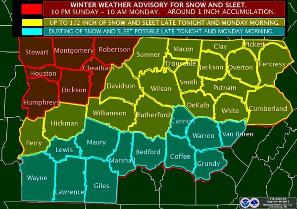 A Winter Weather Advisory for Snow and Sleet is in effect for northwestern Middle Tennessee from 10 pm CST tonight through 10 am CST Monday. Snow and sleet accumulations in the Advisory area will be around one inch. Accumulations up to a half inch are possible as far south as the Interstate 40 corridor…with mainly just a dusting of snow and sleet expected over our southern-most counties. Travel problems will likely develop over the northwest as a wintry mix develops this evening and turns to mainly snow and sleet during the overnight hours…with temperatures falling through the lower 30s and into the upper 20s by sunrise Monday. The best chance for snow and sleet over other areas will develop during rush hour Monday morning. Some slick spots may develop on area roadways…especially along and north of the I-40 corridor. This includes the Nashville Metro area and commuters should expect some travel delays during Monday morning rush hour. Again, mainly just a dusting of snow and sleet is forecast for our most southern counties.
")