

CNF’S EARLY SNOW PREDICTION SLIGHTLY OFF – BY 16 INCHES
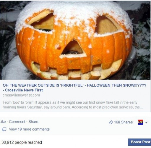 Tuesday evening late, we noticed the weather conditions for early Saturday morning were looking to be ideal for some possible snow ‘flurries’ in the area. We checked all other weather services and news outlets but no one was calling for snow for Halloween in the Crossville area. So, we thought it might be a good idea to go out on a limb and forewarn our viewers there might, perhaps, could be some snow fall for Halloween on the Cumberland Plateau, not something that happens very often. Oh boy. It looked like maybe a ‘dusting’ of snow would fall..possibly a visible layer on the ground. But NO! Most woke to a blanket of snow this morning. Some areas on the Plateau are reporting up to two inches on the ground. Then there are the Smoky’s.
Mt. LeConte has new daily snowfall record of16 inches. The previous record was six inches in 1993.
All lanes of Interstate 40 have been closed at the Tennessee-North Carolina border because of accidents and inclement weather.
The North Carolina Department of Transportation says that Mile Marker 1 through Mile Marker 15 in Haywood County are closed.
The road is expected to reopen by 2:30 p.m
So what do we have to look forward to the rest of the weekend?
Freeze warning remains in effect from 11 PM CDT this evening to 8 am CST Sunday…
Temperatures will drop mainly into the mid 20s across all of middle Tennessee by early Sunday morning.
A freeze warning means sub-freezing temperatures are imminent or highly likely. These conditions can kill crops and other sensitive vegetation. And warm provisions for outdoor pets are in order as well.
")